


Shell Knob Voting District, Barry County, Missouri
About
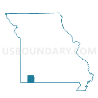
Outline

Summary
| Unique Area Identifier | 607062 |
| Name | Shell Knob Voting District |
| County | Barry County |
| State | Missouri |
| Area (square miles) | 52.77 |
| Land Area (square miles) | 48.10 |
| Water Area (square miles) | 4.67 |
| % of Land Area | 91.15 |
| % of Water Area | 8.85 |
| Latitude of the Internal Point | 36.62208670 |
| Longtitude of the Internal Point | -93.63232470 |
Maps


Graphs
Select a template below for downloading or customizing gragh for Shell Knob Voting District, Barry County, Missouri


Neighbors
Neighoring Voting District (by Name) Neighboring Voting District on the Map
- Alpine Voting District, Stone County, MO
- Flat Creek A Voting District, Stone County, MO
- Golden Voting District, Barry County, MO
- Jenkins Voting District, Barry County, MO
- Mineral Voting District, Barry County, MO
- Roaring River Voting District, Barry County, MO
- Williams Voting District, Stone County, MO
Top 10 Neighboring County Subdivision (by Population) Neighboring County Subdivision on the Map
- White River township, Barry County, MO (2,498)
- Flat Creek A township, Stone County, MO (1,590)
- Roaring River township, Barry County, MO (1,333)
- Williams township, Stone County, MO (1,207)
- Shell Knob township, Barry County, MO (1,177)
- Mineral township, Barry County, MO (861)
- Alpine township, Stone County, MO (686)
- Mountain township, Barry County, MO (306)
Top 10 Neighboring Place (by Population) Neighboring Place on the Map
Top 10 Neighboring Elementary School District (by Population) Neighboring Elementary School District on the Map
Top 10 Neighboring Unified School District (by Population) Neighboring Unified School District on the Map
- Reeds Spring R-IV School District, MO (16,588)
- Cassville R-IV School District, MO (11,765)
- Blue Eye School District, MO (5,399)
Top 10 Neighboring State Legislative District Lower Chamber (by Population) Neighboring State Legislative District Lower Chamber on the Map
Top 10 Neighboring State Legislative District Upper Chamber (by Population) Neighboring State Legislative District Upper Chamber on the Map
Top 10 Neighboring 111th Congressional District (by Population) Neighboring 111th Congressional District on the Map
Top 10 Neighboring Census Tract (by Population) Neighboring Census Tract on the Map
- Census Tract 9601, Barry County, MO (6,127)
- Census Tract 904, Stone County, MO (5,399)
- Census Tract 902, Stone County, MO (4,950)
- Census Tract 9606, Barry County, MO (2,767)